

3/2 AM Update: We got an inch of snow/sleet Tuesday night that’s getting wiped out with rain and temperatures in the middle-30s. Temperatures will drop off rapidly today with a freeze up. Probably not worth riding for most…
Temperatures hitting the upper 40s on Sunday, plus a bit of rain Monday morning have put us another step closer to oblivion.
Sure, the trails still have a firm icy base “in the woods.” But the exposed areas are cooked to the point that conditions resemble the end of March or early April around here.
NOTE: The Town of Indian Lake advised me that DEC has closed the gates to Moose River Plains at Cedar River Headquarters until further notice, presumably due to poor conditions. If I hear of DEC reopening the gates later this week, I will pass that along.
Midweek Outlook:
Colder air returning Monday night and Tuesday will staunch the bleeding. All eyes are on the next system for Tuesday night into Wednesday.
I have little doubt that it will be a significant snow event for somewhere in northern New York. It just depends on what side of the tracks you’re on.
The RGEM is a short term model that I like to use once the systems hit the 1-2 day range. I’m confident we’ll start as snow here for Tuesday night, but the close approach of the storm center is likely to bring a changeover to sleet and freezing rain for ilsnow land early Wednesday:
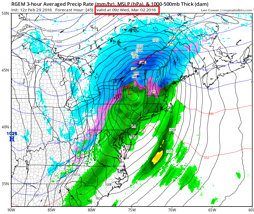
As the storm passes by, there would be a shift back to snow Wednesday morning. It’s going to be a tight call as to who gets all snow and who gets mix. We can hope the models latch on to a south/eastward trend to keep it all snow for Indian Lake and vicinity. But the modeling has been rather consistent on the close track.
Here is the snowfall forecast from RGEM through 7 am Wednesday:
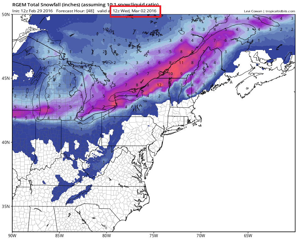
You can see the tight gradient in total snow accumulation. The axis of heavy snow is expected to fall over the the St. Lawrence Valley, northern Adirondacks and northern Champlain Valley. Obviously, a slight error in the modeling is going to result in greatly more (or less) snowfall for places along the battle line.
Once the storm goes by, a pretty good shot of cold air will grip the region for the end of the week. This will likely give us our final few sub-zero mornings of this snowmobiling season.
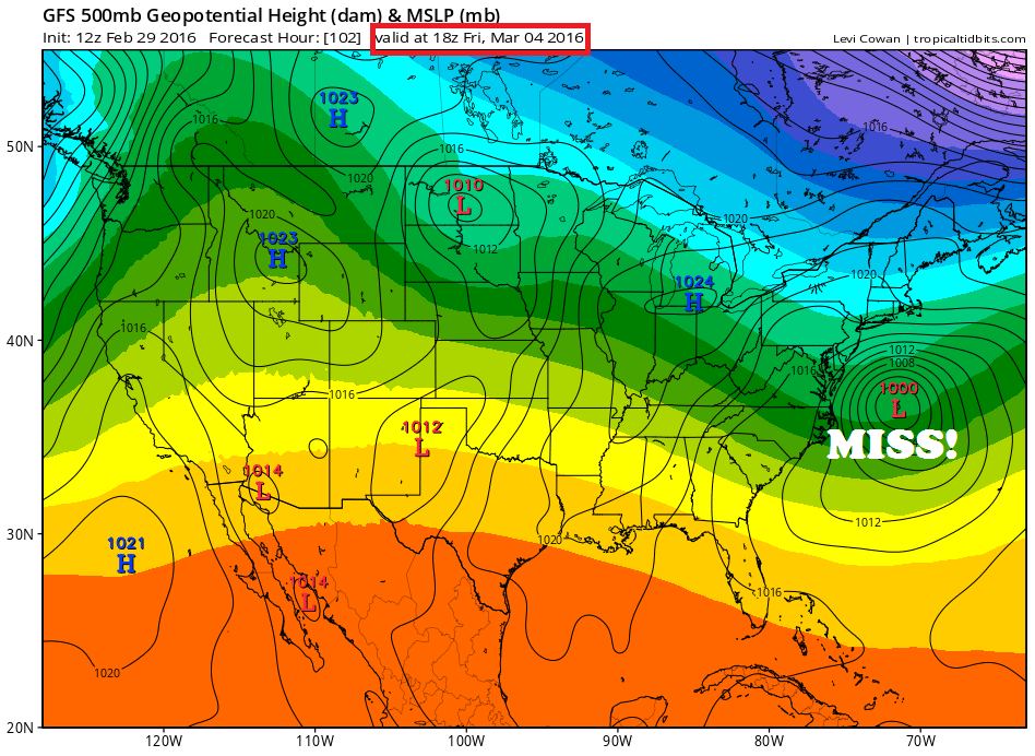
The next event on Friday should be a clean miss:
Weekend Outlook:
3/2 Update: Want good snow? Go to Canada!
Extended Outlook:
The wheels begin to fall off Ole’ Man Winter for good. By next week, the Polar Vortex (PV) retreats to the Davis Straits and we get the warm blowtorch:

The week after that? Not looking good either:

With the paltry snow cover we have now, it won’t take long for the strong March sun and warmer temperatures to wipe us out:
So there you have it! Maybe another fuel stabilizer ride for those who missed out last week…
For the ilsnow nation,
Darrin
