

The first 7 days of January have been amazingly cold here in ilsnow land!
Average max: 3.4*F
Average min: -16.6*F
On three of those days, the temperature remained subzero all day. The lowest temperature at Indian Lake (official) was -24*F on the morning of January 7th.
With the bitter cold, snow has been hard to come by outside of the lake-effect areas. Indian Lake has only picked up 1.8″ of snow in the New Year.
As I type, this cold Arctic siege is breaking down. So what’s next?
This week
A weather system will move through ilsnow land on Monday with snows probably in the 3-6 inch range for the central Adirondacks. Wind will kick up Monday night and blow the snow around. But the accompanying air mass will not be anywhere as cold as we’ve had it over the past week.
Then a deep trough moving into the central United States will pump up a ridge over the eastern United States by Thursday:
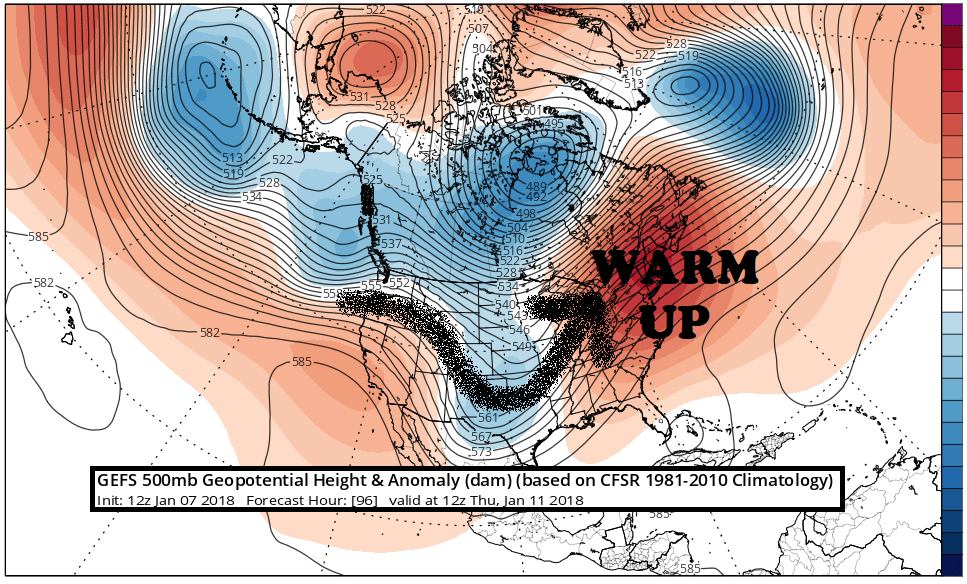
This will cause trouble for us, with temperatures pushing into the 40s in most places later Thursday into Friday morning, before a cold front is expected to drop temperatures Friday afternoon. Rainfall with these temperatures would cause snowmobile trail damage, depending on how much rain we end up getting.
Then what?
A storm is forecast to approach us Friday night into Saturday as Canadian high pressure funnels cold air into the northeastern United States:
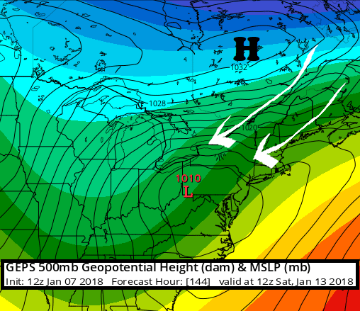
Depending on the track of the weather system, we could be in for a significant ice storm or perhaps a snow event with ice changing to snow.
There will be a very sharp temperature gradient across the storm on Saturday:
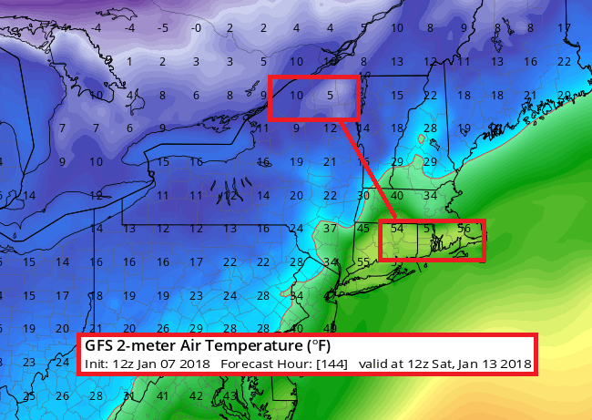
This tells me 2 things:
1. With a temperature contrast like this, there would be plenty of energy for the storm to feed from.
2. A seemingly minor model error in the storm track would make a big difference in the outcome.
So, this is certainly not set in stone by any means for an event that’s still several days away.
After that?
After Saturday’s event, seasonably cold air would be in place for several days. But then we have more trouble on the way as the flow goes zonal over North America during the January 18-23 time frame:

And the resultant temperature anomaly pattern for that time period would look like this:
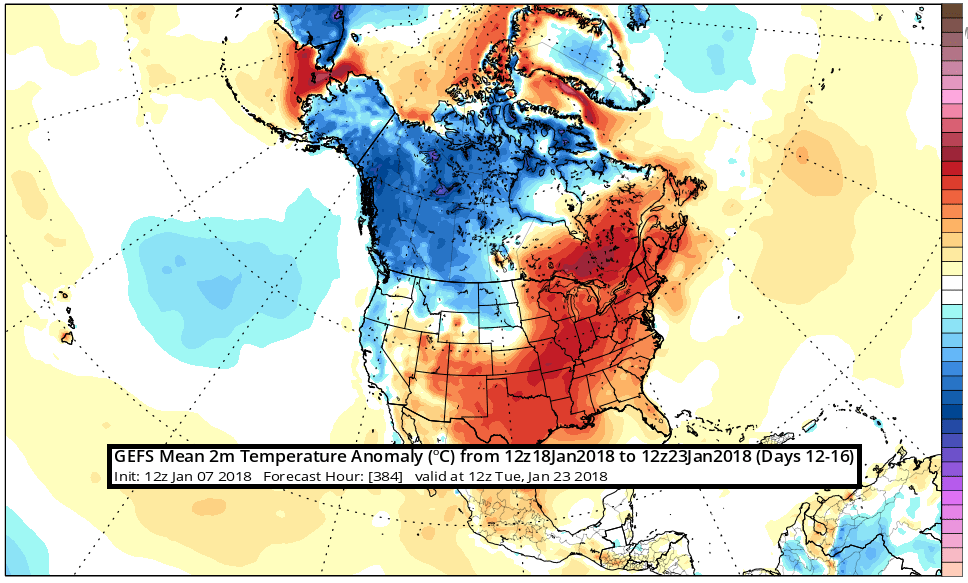
I usually restrict myself to looking at the weather in 1-2 week chunks, but I would say that much of the second half of January may not be favorable for snowmobiling.
So, Is Winter’s Done?
Of course not, but I can’t tell you whether we’ll return to something like we’ve had for the past 3-4 weeks.
So…drop a dime on a sick day this week and grab the best of what we’ve got before things go sour for a while. And while you’re at it, keep your fingers crossed that Saturday will do something good for us before the January Thaw settles in.
For the ilsnow nation,
Darrin
This report is brought to you by Adirondacks Speculator Region Chamber of Commerce. Speculator has long been one of my favorite places to ride! There are lots of options, whether you want to ride around Speculator for the day, or launch a 250 mile mega-miler. Speculator is loaded with businesses eager to cater to snowmobilers. Look them up at the Speculator Chamber and grab a copy of their snowmobile trail map. Be sure to tell them that Darrin @ ilsnow.com sent you.
