

Since the January 11-12 thaw and heavy rain event, we’ve been engaged in an up-and-down weather pattern which likely will continue into early February.
Over the next 7-10 days, there appears to be little hope for significant snow.
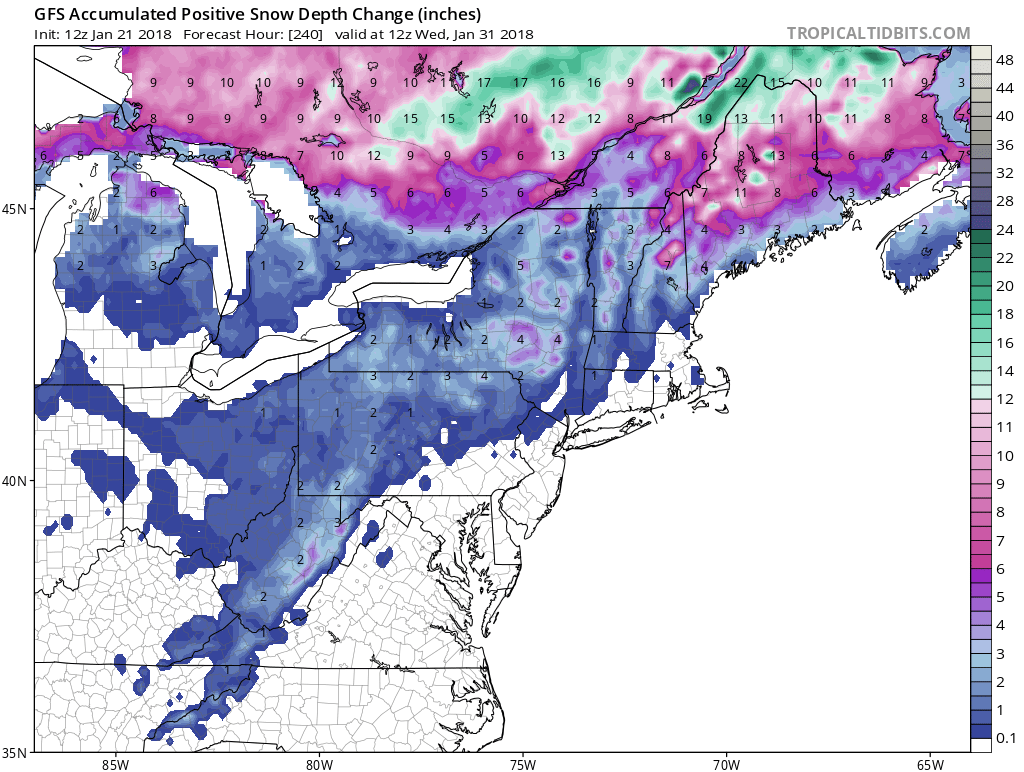
Not that I trust model-ology to accurately pinpoint snow events a week or more away, but the GFS snow forecast for the remainder of January appears quite bleak:
Tuesday will feature another thaw and rain, followed by a good cold shot for mid-week. But I’m quite worried about a stronger thaw and rain around next Sunday, January 28th as a high amplitude plows eastward from the central United States:
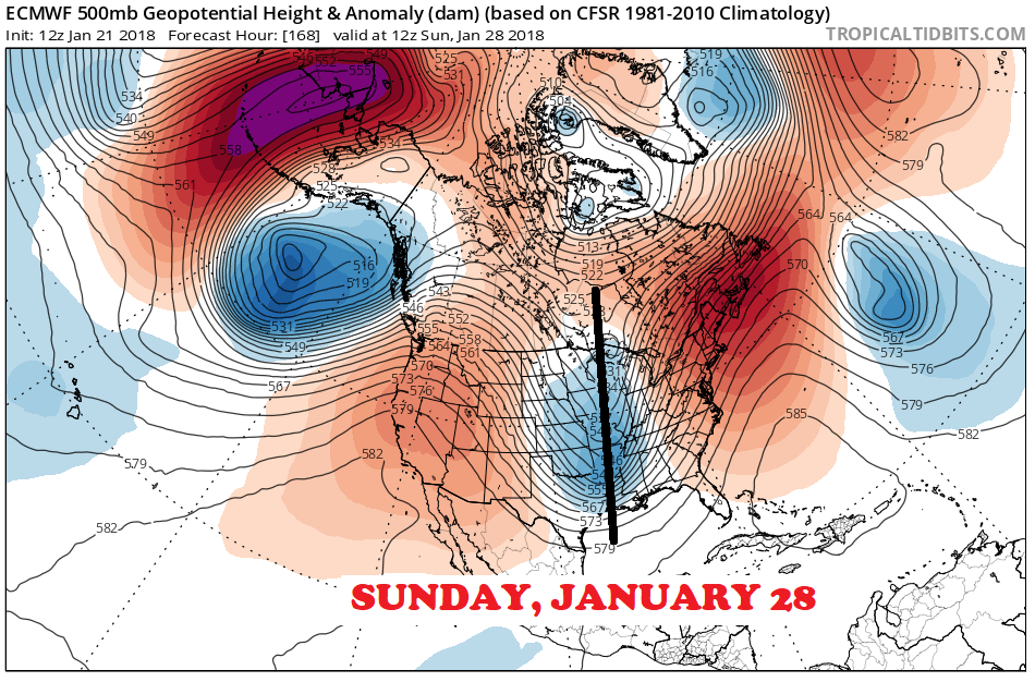
With absolutely no high latitude blocking to keep cold air in locked in place ahead of this system, we’re left wide open to the probability of a game-wrecking thaw and rain, similar in scope to January 11-12 or perhaps even worse.
Then what?
I’m going to jump into mid-February, then work backwards. The long range CFSv2 ensembles have long been insisting on a strong EPO- pattern to develop by mid-February.
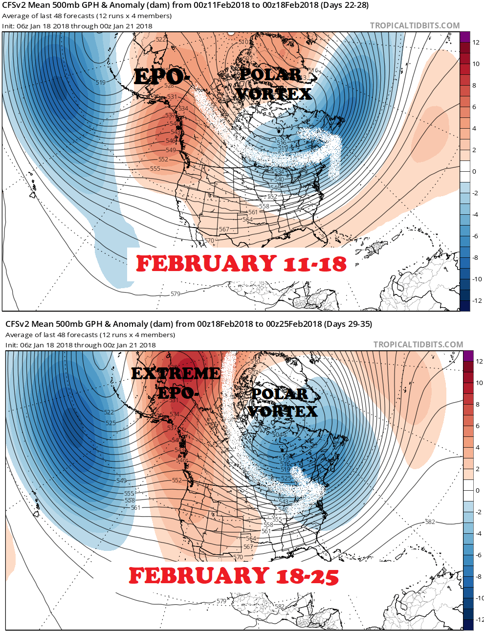
Remember: The negative phase of the East Pacific Oscillation (EPO-) is marked by ridging over Alaska, which drives cold air into the eastern United States.
The time around Presidents Week 2018 may be especially cold with extreme EPO- tapping into a brutally cold-cross polar flow.
The transition
It appears the next 1-2 weeks will be bad for us AND we could be back into hard-core winter by mid-February.
So, what happens in between? Well, the transitions are always the fuzzy part. As per GEFS ensembles, mighty cold air should overspread Canada and start to spill into the north-central United States in early February:
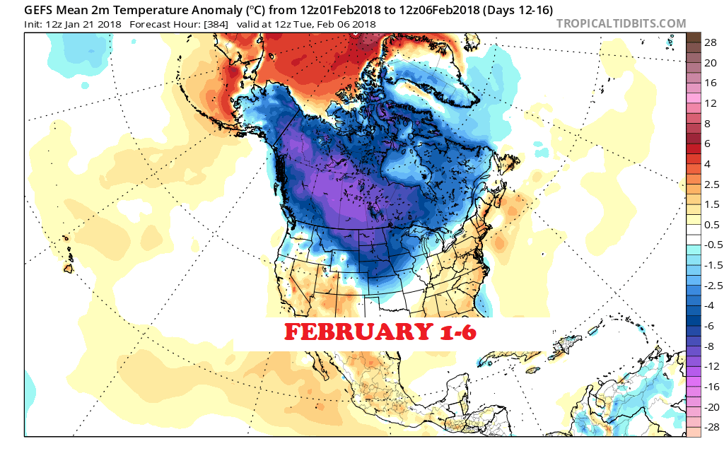
With that kind of cold waiting in the wings, pressing south and east, it would make sense to be in the running for significant snow events some time during the first half of February as strong weather systems move along the boundary ahead of the bitter cold air-mass.
But, I couldn’t set my watch by it, much less mark it on a calendar. So we’ll have to watch for details to come into place as time grows closer.
Bottom line
Winter has shown me a lot already, so I believe that a transition back to a nearly bottomless cold weather regime for mid-late February could have serious teeth. But we’re probably in for a couple weeks of tough sledding before we can get excited again.
For the ilsnow nation,
Darrin
This report is brought to you by Pilot Knob Marina in Lake George. Just get off Northway I-87 Exit 20, then follow NY Route 149 East until you hit the junction of NY Route 149 and Bay Road. Pilot Knob Marina features a wide selection of new and pre-owned Arctic Cat snowmobiles & ATVs. If you see Nick Barber, tell him that Darrin @ ilsnow.com sent ya!
